Prevent pipeline failures and illegal construction, before they cause damage
Earth Observation Intelligence for pipeline monitoring
Why pipeline monitoring fails today?
Regulatory barriers slow everything down
Airspace permissions, restrictions on autonomous flights, and compliance issues make drone-based monitoring complex, slow, or impossible in many regions.
Drones can’t stay in the air long enough
Short flight times mean fragmented coverage, gaps in data, and expensive, repeated missions with human operators.
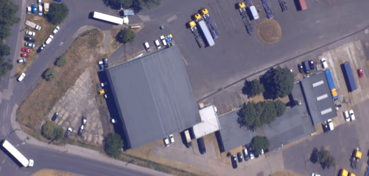
Manual inspections don’t scale
Ground patrols and visual checks are slow, expensive, and often detect problems after damage has already started.
Satellites miss critical details
Satellites don’t offer the resolution or the update frequency needed to spot early ground movement or small, risky construction activity.
Small ground movement and early-stage construction are invisible until they become expensive - or dangerous. By the time traditional methods catch them, the risk is already real.
How Resoloon changes this
Cost-Effective Pipeline Monitoring
Continuous, wide-area monitoring
Keep long pipeline sections under persistent observation instead of relying on occasional snapshots.
Higher resolution than satellites
Spot early signs of ground subsidence and small-scale construction activity before they become critical.
Medium length section heading goes here
Our stratospheric platform avoids the regulatory and operational bottlenecks of drone flights.
Medium length section heading goes here
Reduce field inspections and repeated drone deployments with automated, persistent observation.
With Resoloon, you move from reactive inspections to early risk detection.

Built for Organizations Responsible for Large, Critical Areas

Detect ground subsidence and unauthorized construction near your pipelines before they turn into incidents.

Spot early ground movement, identify risky construction activity, and respond faster to potential threats

Continuously monitor long pipeline corridors with high-resolution aerial data
Pipeline Monitoring Without Blind Spots
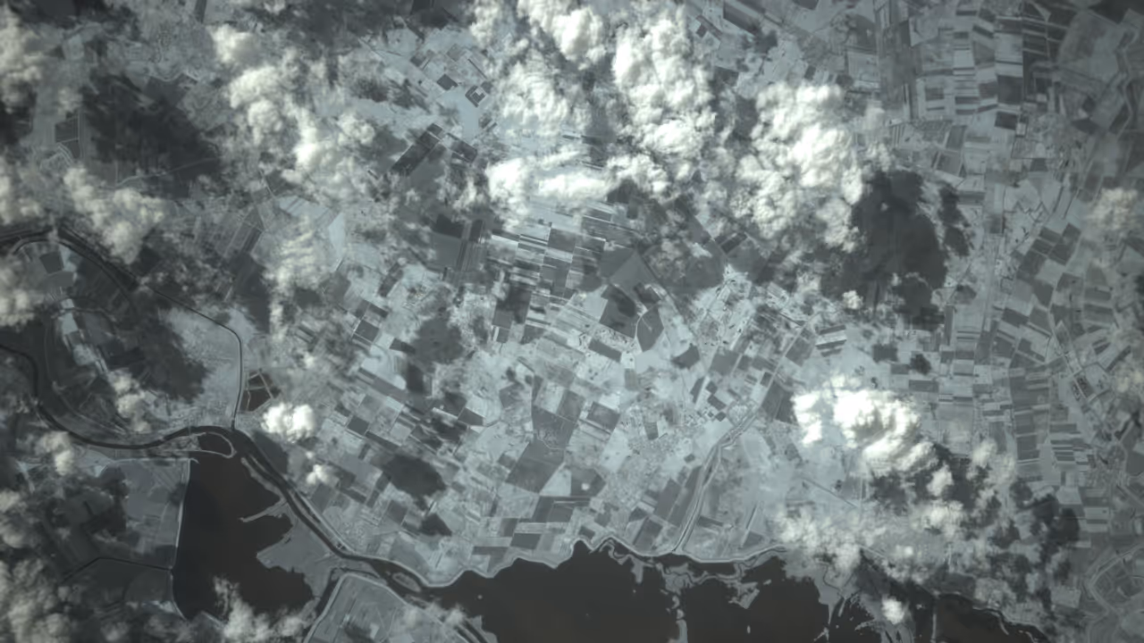
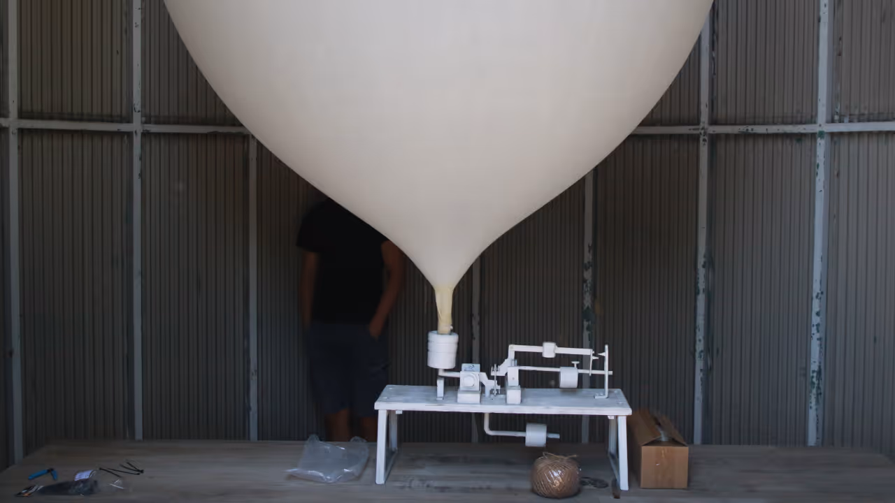
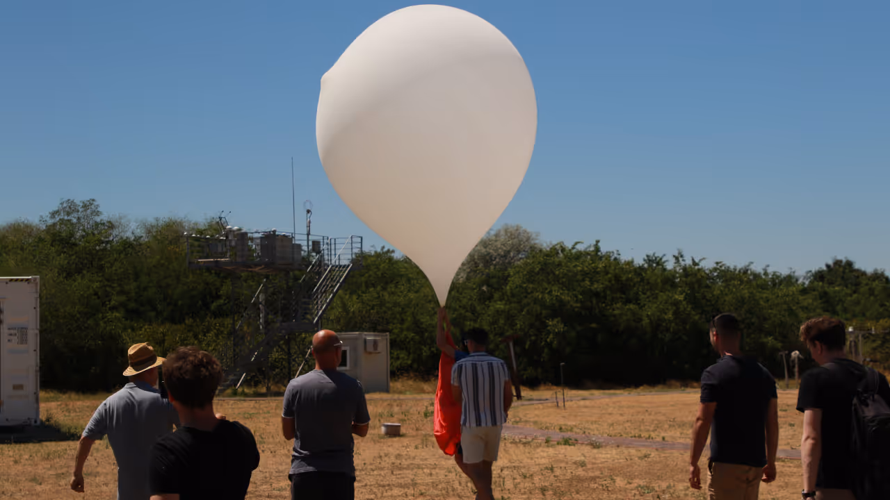
Resoloon uses high-altitude, navigable balloon platforms operating around 30 km above Earth to continuously monitor long pipeline corridors.
This enables wide-area, high-resolution, long-endurance observation that drones, satellites, and aircraft can’t deliver cost-effectively.
The result: fewer failures, lower inspection costs, faster response, and safer pipeline operations at scale.
50 cm resolution
See early signs of ground subsidence, soil movement, and small-scale construction activity before they become critical.
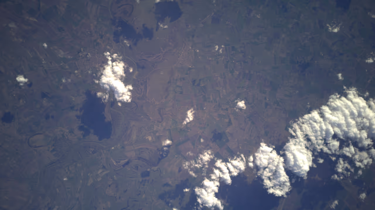
800 km² coverage
Monitor entire pipeline sections and surrounding risk zones - not just isolated points or short segments.
1-day continuity
Stay up to date with evolving risks instead of relying on weekly or monthly snapshots.

~$0.50 / km²
Make continuous, large-scale pipeline monitoring economically viable - not just occasional inspections.
Persistent Monitoring Without Constant Operations

AI Navigation System
We use a proprietary wind prediction model to keep our high-altitude platform over your pipeline corridors for extended periods.
This enables continuous monitoring of critical sections without constant human control or repeated drone missions.

Optical & Thermal Imaging
Resoloon uses high-resolution optical sensors to detect ground subsidence and terrain changes.
This makes it possible to spot small but critical changes across long pipeline sections.

Analytics & Data Platform
We turn raw aerial data into maps, measurements, change detection, and alerts tailored to pipeline monitoring - so your team can focus on decisions, not data processing.
What We’ve Already Built
6 successful stratospheric missions completed
50 cm ground resolution achieved
1-day flight duration achieved (with 800 km² coverage)
End-to-end analytics pipeline operational
Wind model validated
Related Posts

Why Earth Observation Is Expensive & How Resoloon Fixes ItQuick introduction
Traditional satellite imagery forces you to choose between cost, coverage, and detail. Resoloon delivers high-resolution monitoring without the tradeoffs.

Why Earth Observation Is Expensive & How Resoloon Fixes ItQuick introduction
Discover how Resoloon made the Forbes 30 Under 30 2026 list. From high-altitude balloons to the Forbes cover, go behind the scenes of our startup journey.
Meet our team

Worked on autonomous underwater quality assurance submarines.

Worked in advisory and in startups.

Theoretical physicist who worked on airplane navigation optimization

Built precision embedded data processing systems.

Built space grade electronics and military drones.

Designing and building hardware systems
Book a short discovery call
with us to walk through your area, your constraints, and your goals. We’ll tell you honestly whether Resoloon is a good fit - and if it is, we’ll outline a pilot setup tailored to your needs.
What Happens After You Book a Call
Quick introduction
We start by understanding
what area you’re responsible for, and
what problem you’re trying to solve.
Your problem & constraints
You walk us through:
what you’re monitoring today
what’s not working with your current setup
what matters most: resolution, coverage, speed, cost, or continuity.
We map possible solutions
Based on your use case, we explain:
whether Resoloon is a good fit
how a pilot could look for your area
what’s realistic today - and what’s not (we’ll be honest)